|
||||||||||||||||||||||||||||
 |
||||||||||||||||||||||||||||
|
||||||||||||||||||||||||||||
|
||||||||||||||||||||||||||||
|
||||||||||||||||||||||||||||
|
||||||||||||||||||||||||||||
![]()
![]()
![]()
![]()
![]()
more mapping + GPS resources:
|
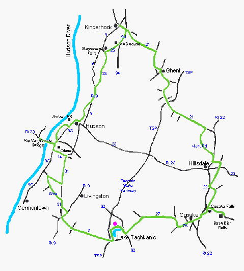
. . . GPX file with all tracks + key waypoints, or by section ... |
|
| A) Taghkanic to Hudson [bhve4a]: | map on Bikely | Google Earth KML | GPX |
| B) Hudson - Kinderhook - Chatham [bhve4b]: | map on Bikely | Google Earth KML | GPX |
| . . . var AB) Taghkanic-Chatham [bhve4av]: | map on Bikely | Google Earth KML | GPX |
| C) Chatham - Copake - Taghkanic [bhve4c]: | map on Bikely | Google Earth KML | GPX |
Route not checked by us since 2009 -- learn more | see Reports
Description | Cue Sheet | Reports | more Routes | About this Map
|
|
|
Home |
Routes
| Main Map | Find
Partners | Discuss | Contact Us
|
|
|
To send us questions or comments about this website, see the contact information -- -- Homepage is www.roberts-1.com/bikehudson |
|
|
© Copyright 1999-2002 Kenneth S. Roberts. Terms of Use |
|