|
||||||||||||||||||||||||||||
 |
||||||||||||||||||||||||||||
|
||||||||||||||||||||||||||||
|
||||||||||||||||||||||||||||
|
||||||||||||||||||||||||||||
|
||||||||||||||||||||||||||||
![]()
![]()
![]()
![]()
![]()
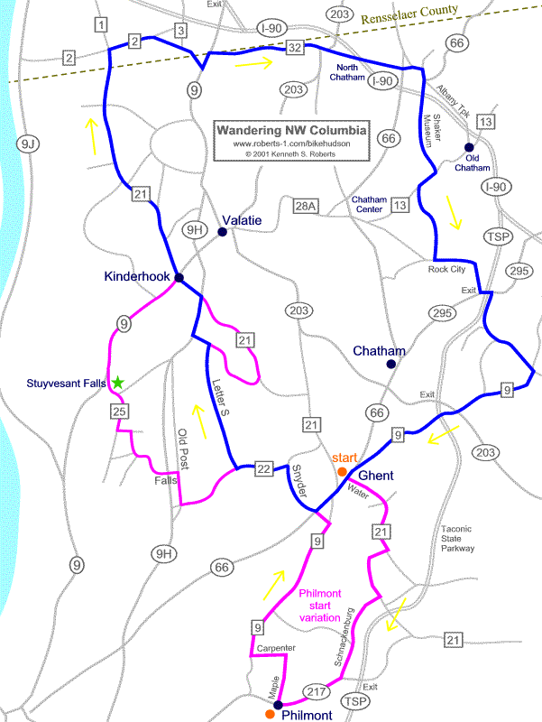
Try other map resolutions for viewing and
printing:
[ Printing ] . . . [
Large-resolution ]
digital mapping resources + GPS . . .
GPX file with all tracks + key waypoints : [ map on Bikely | Google Earth KML | GPX ]
Philmont start-finish: [ map on Bikely ]
Route not checked by us since 2010 -- learn more | see Reports
Philmont start-finish not checked by us since 2010 -- learn more | see Reports
Description | Cue Sheet | Reports | more Routes | About this Map
|
|
|
Home |
Routes
| Main Map | Find
Partners | Discuss | Contact Us
|
|
|
To send us questions or comments about this website, see the contact information -- -- Homepage is www.roberts-1.com/bikehudson |
|
|
© Copyright 1999-2002 Kenneth S. Roberts. Terms of Use |
|