|
||||||||||||||||||||||||||||
 |
||||||||||||||||||||||||||||
|
||||||||||||||||||||||||||||
|
||||||||||||||||||||||||||||
|
||||||||||||||||||||||||||||
|
||||||||||||||||||||||||||||
![]()
![]()
![]()
![]()
![]()
Try other map resolutions for viewing and
printing:
[ Printing ] . . .
[ Large resolution ]
| GPS + digital mapping |
|
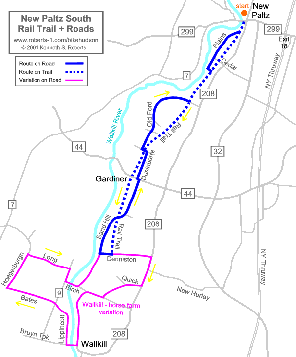
A) rail trail south fr New Paltz [bhvw12a]: map on Bikely | KML | GPX B) roads back north to New Paltz [bhvw12b]: map on Bikely | KML | GPX v) Wallkill + horse farm variation [bhvw12v]: map on Bikely | KML | GPX GPX file with all tracks on one map |
|
Description | Cue Sheet | Reports | More routes | About this Map |
|
|
|
Home |
Routes
| Main Map | Find
Partners | Discuss | Contact Us
|
|
|
To send us questions or comments about this website, see the contact information -- -- Homepage is www.roberts-1.com/bikehudson |
|
|
© Copyright 1999-2002 Kenneth S. Roberts. Terms of Use |
|