|
||||||||||||||||||||
 |
||||||||||||||||||||
|
|
|
|||||||||||||||||||
|
|
|
|
|
|||||||||||||||||
|
|
|
|
||||||||||||||||||
|
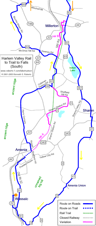
Map Format |
|
|||||||||||||||||||
|
back to Top |
|
|||||||||||||||||||
|
||||||||||||||||||||
|
||||||||||||||||||||
|
|
||||||||||||||||||||
|
|
|
|||||||||||||||||||
|
|
|
|
|
|||||||||||||||||
|
|
|
|
||||||||||||||||||
|
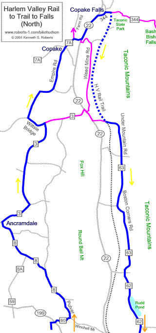
Map Format |
|
|||||||||||||||||||
|
back to Top |
|
|||||||||||||||||||
|
||||||||||||||||||||